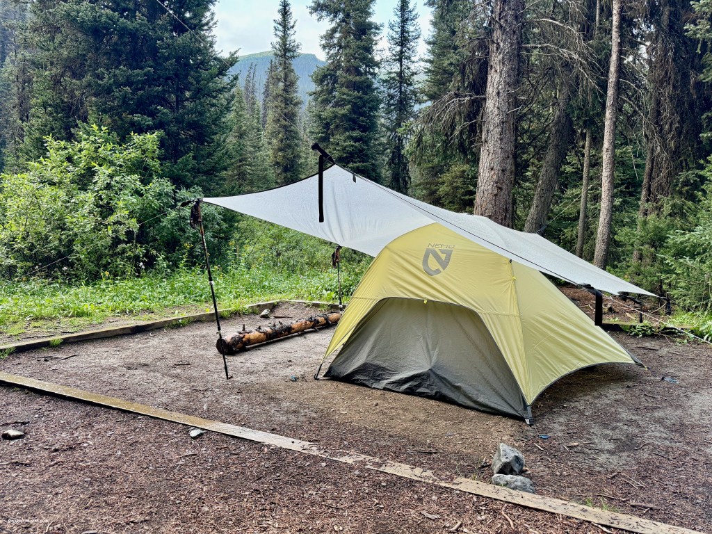
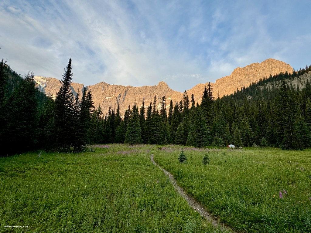
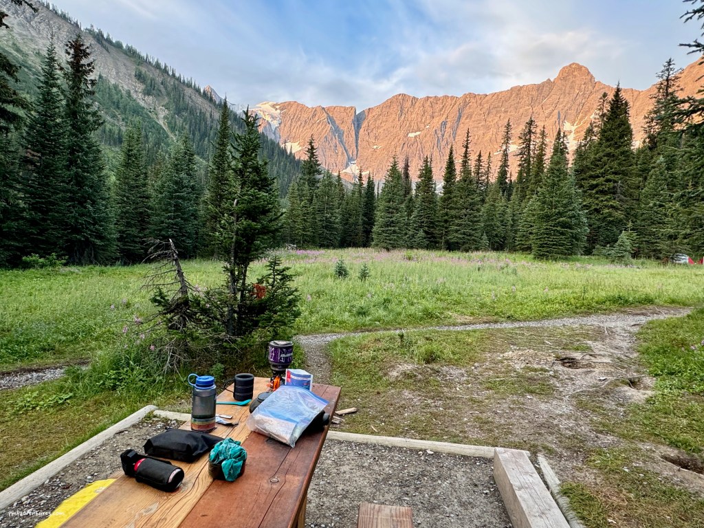
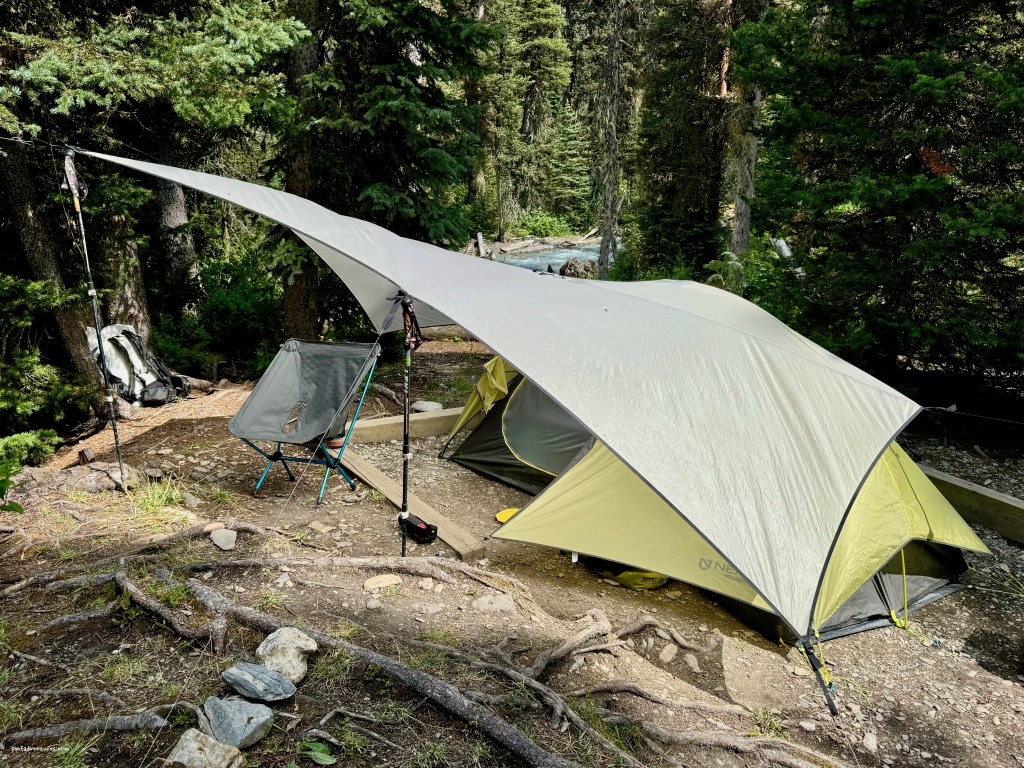
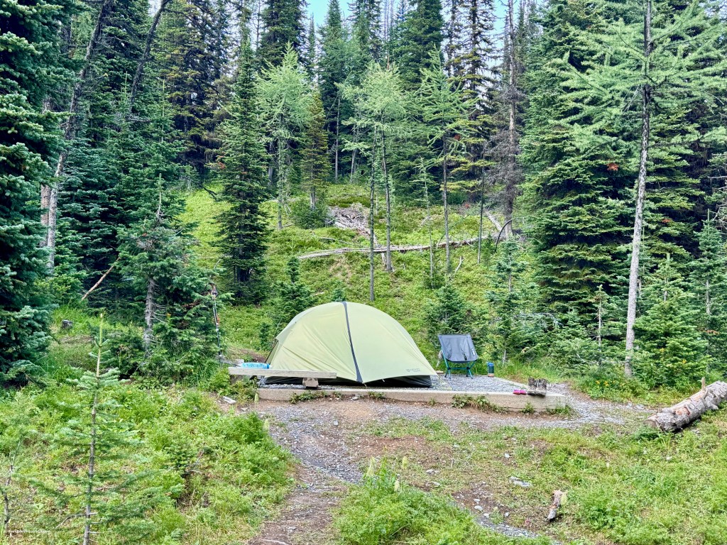
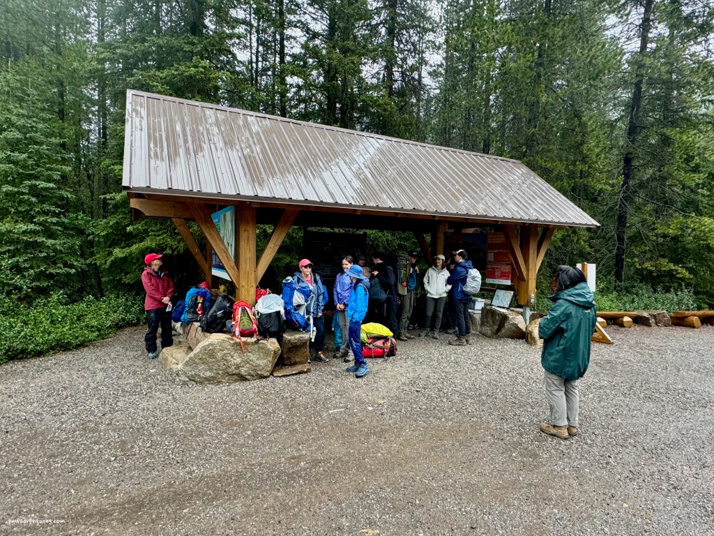
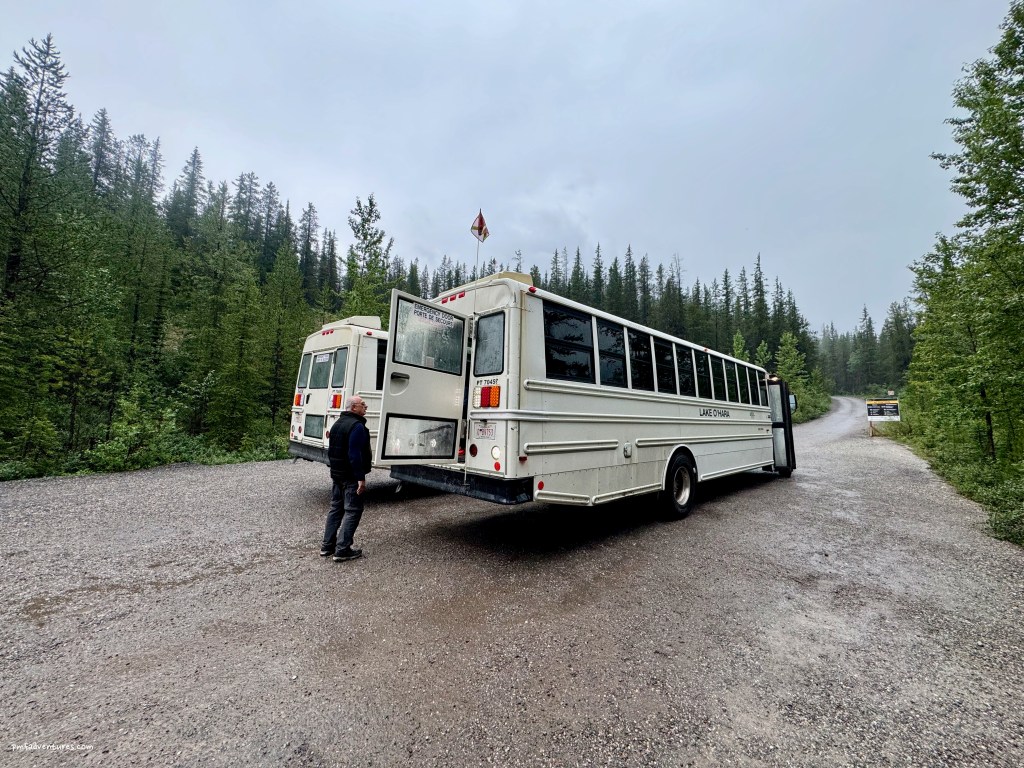
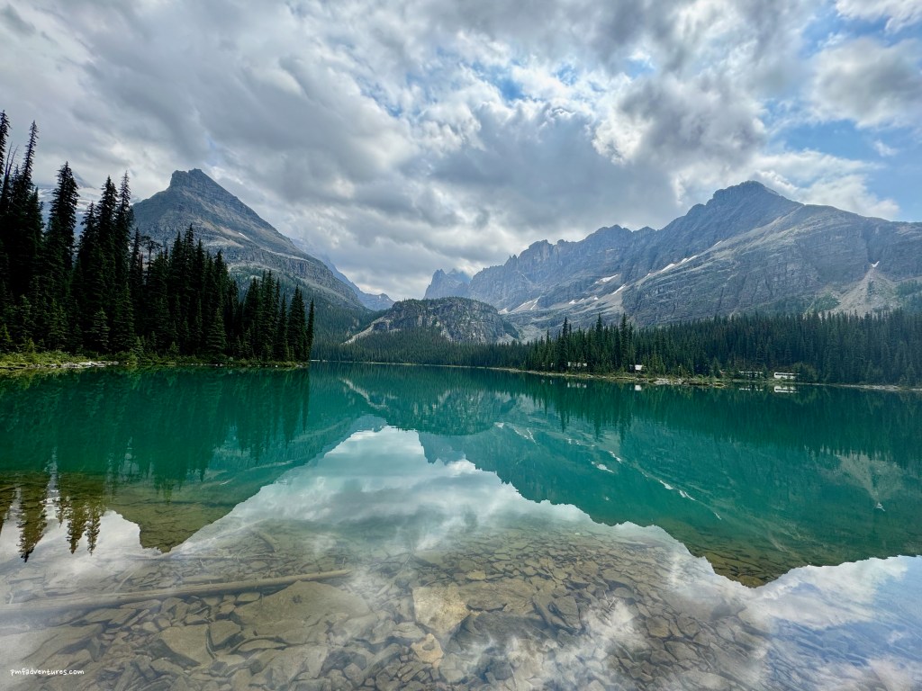
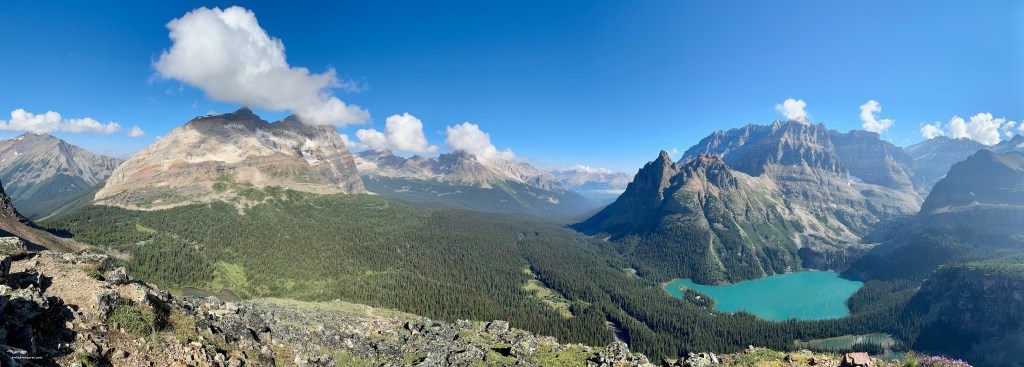
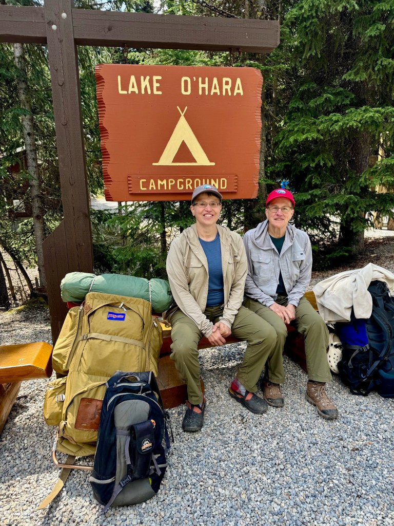
Back in January, I felt like we had won the lottery when we scored three nights at the Lake O’Hara Campground in Yoho National Park for August. Now that we’ve been there, I know just how lucky we were to get to spend that much time at Lake O’Hara. We had quite a bit of rain, but that didn’t prevent us from getting in some great hikes, and the upside is that the rain cleared out all the smoke from nearby wildfires. Lake O’Hara Campground is a backcountry campground, but instead of having to carry all of your gear in on your back, you get to load it in a duffel bag and put in on a bus for the 6 mile drive to camp.
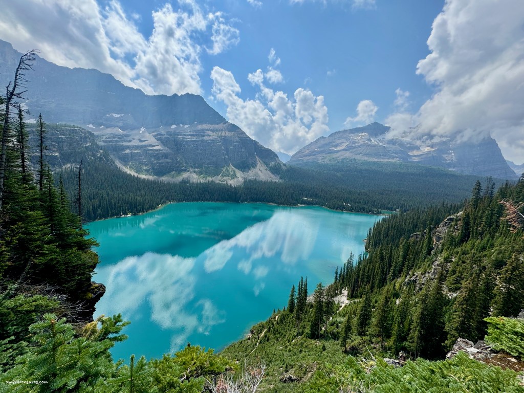
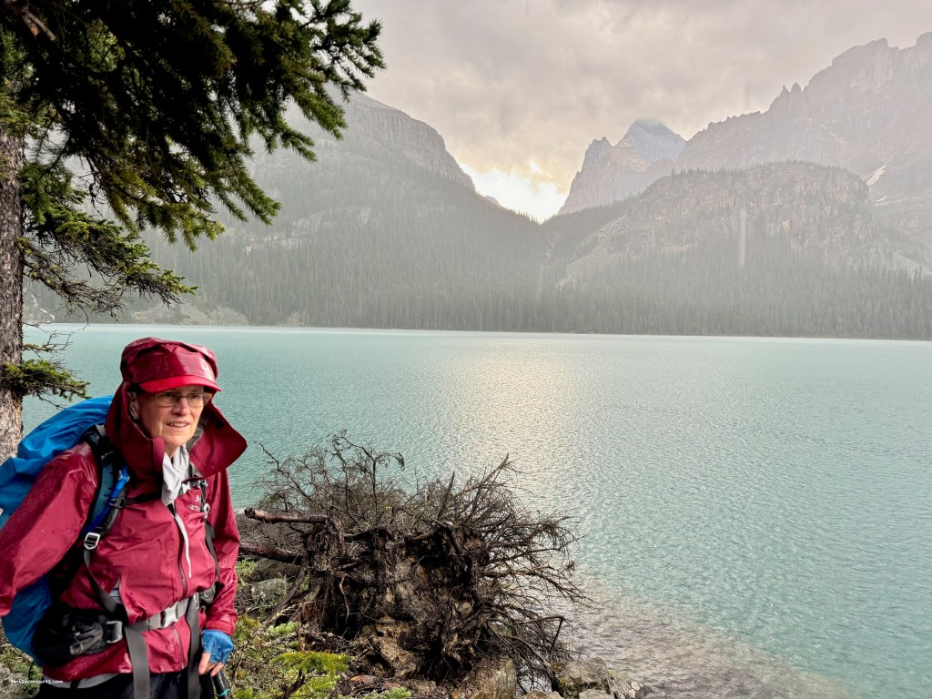
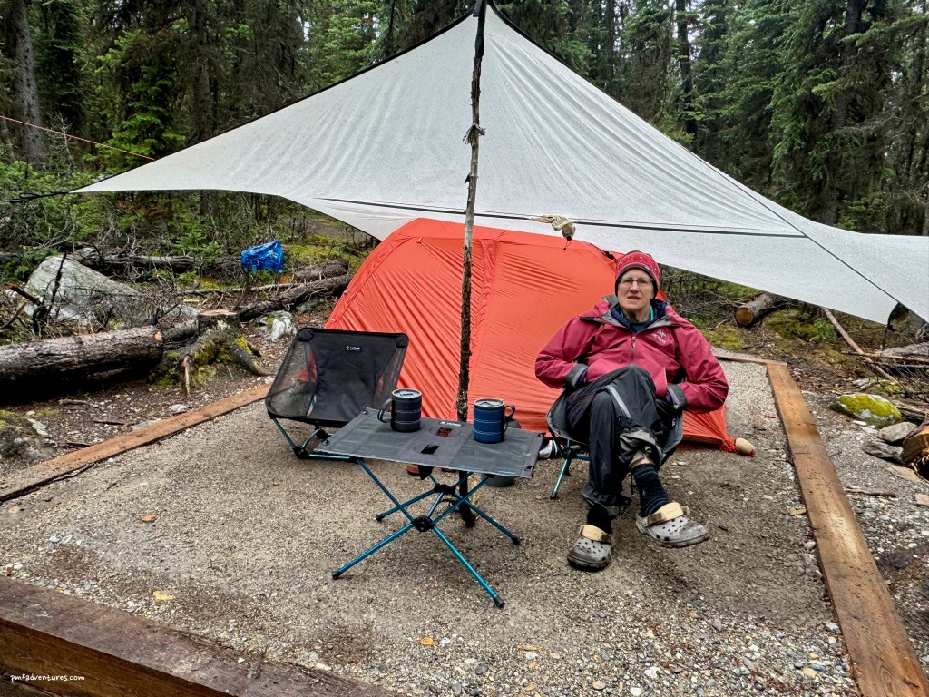
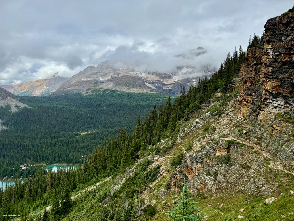
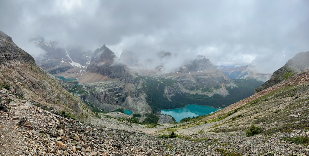
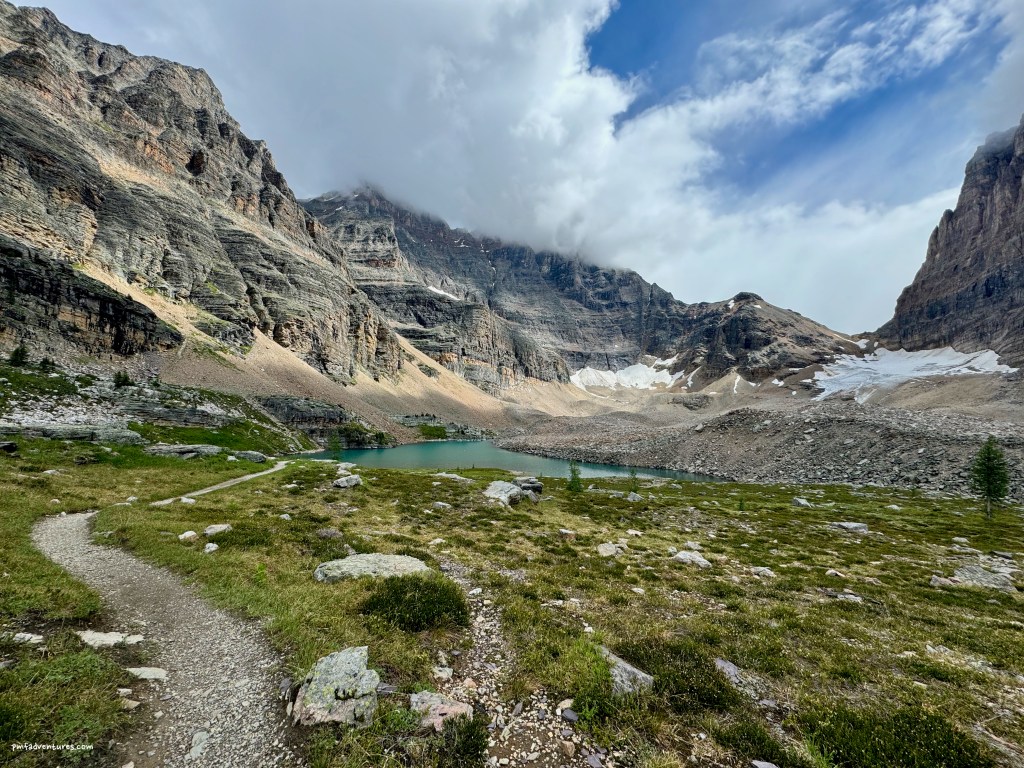
We were in full raingear as we waited for the 10:30 AM bus on August 5, as it was just pouring. By the time we got to the campground, it was still quite cloudy, but it had stopped raining. So we got our camp set up, had a quick snack, and set off on a hike around Lake O’Hara and up to Lake Oesa. The thunderstorms started rolling in as we were descending from Lake Oesa, but fortunately the rain held off until we got down off the exposed talus. We quickly put our raingear back on and finished the hike in pouring rain and occasional hail. We were thankful that the campground has two cooking shelters, as we were able to cook dinner and eat inside out of the rain.
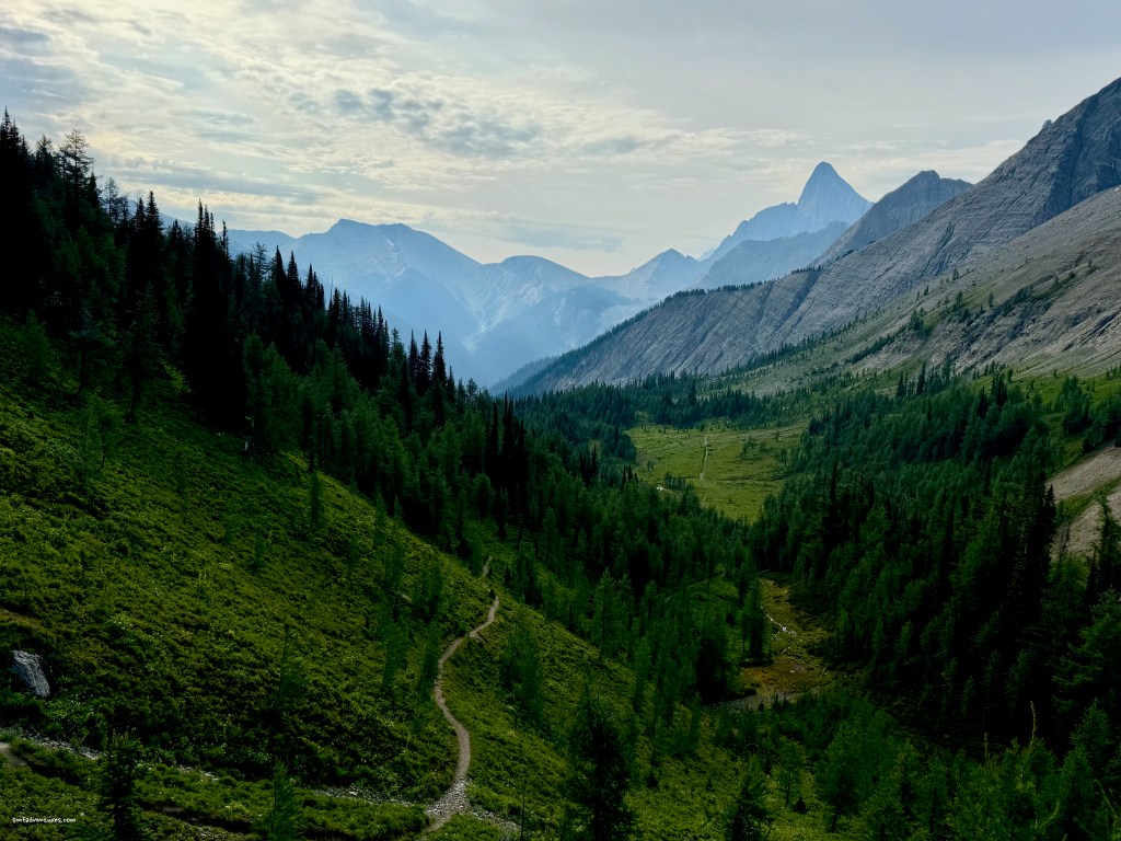
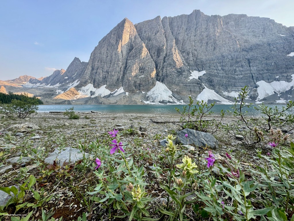
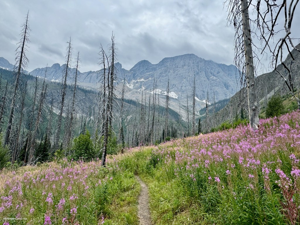
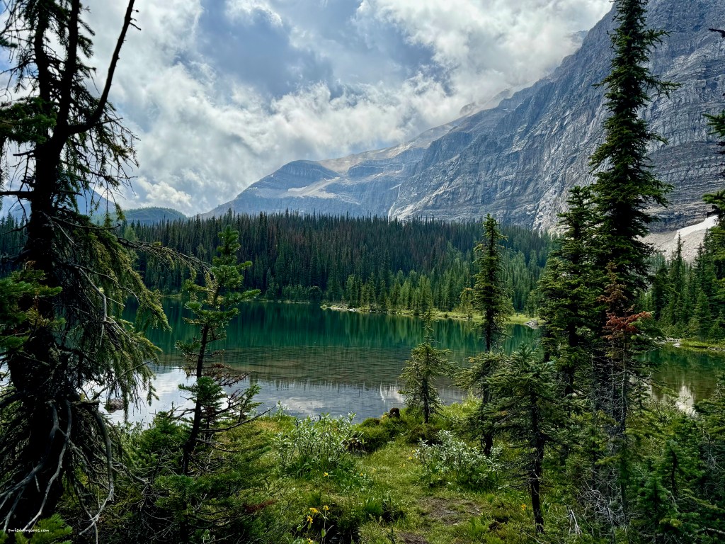
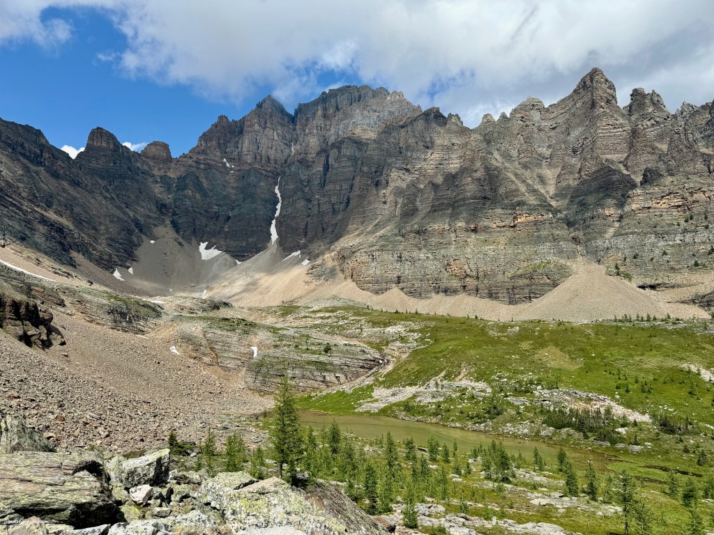
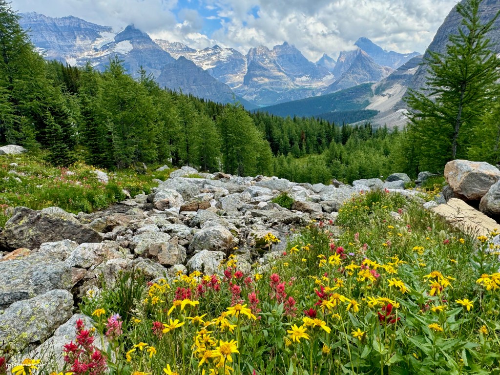
It rained multiple times overnight, so we awoke to a soggy morning on August 6, but it wasn’t raining when we got up for breakfast. After enjoying our second cup of coffee/tea under our tarp during another rain shower, it seemed like the weather was going to clear for a while, so we headed off to Linda Lake. While Sue kept going around Linda Lake, I climbed up to Cathedral Basin to get a great view back across the valley and also enjoyed magnificent wildflowers.


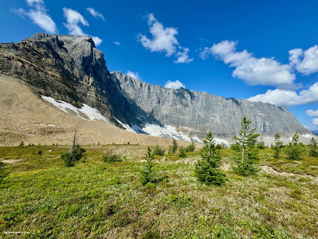
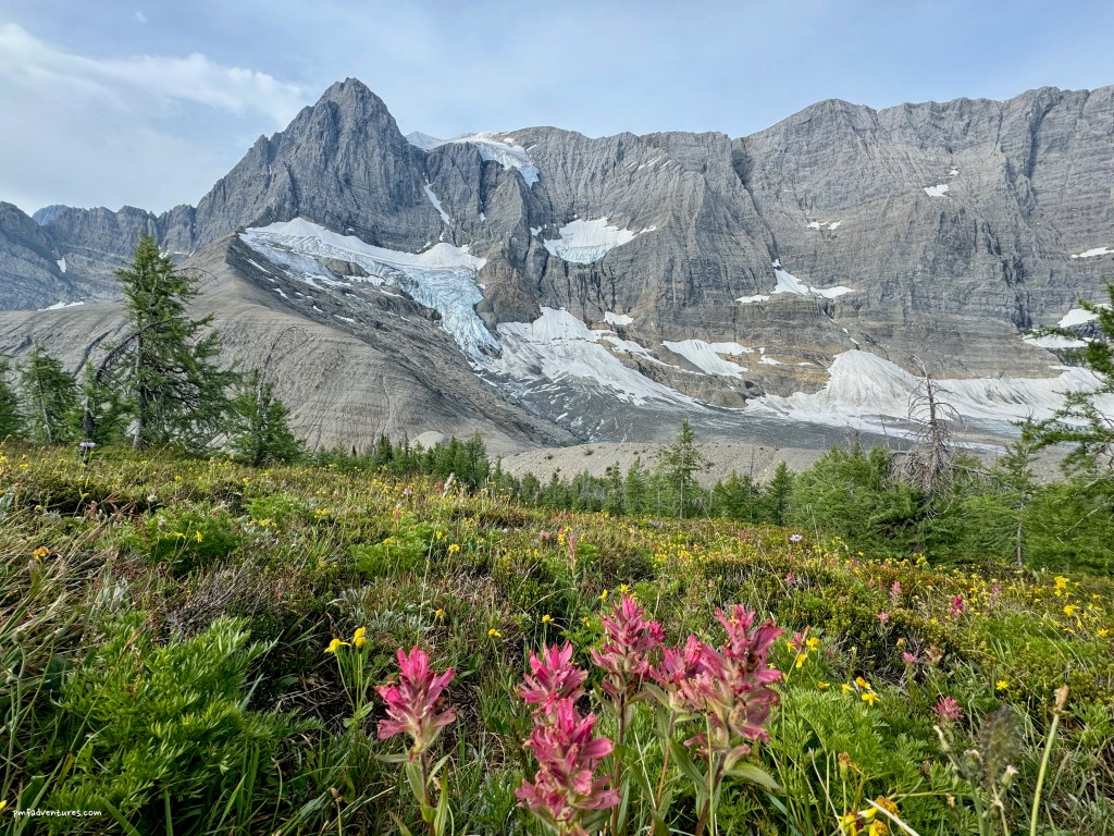
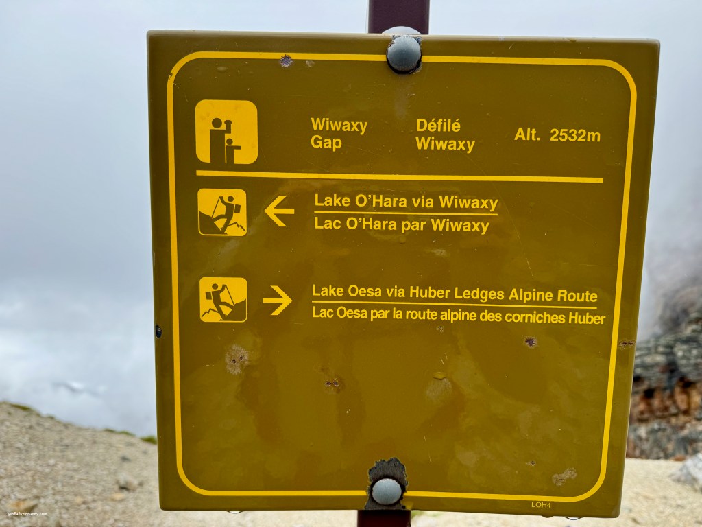
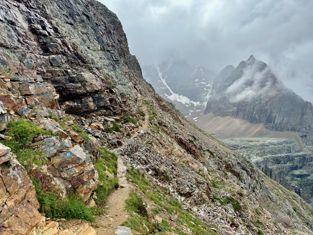
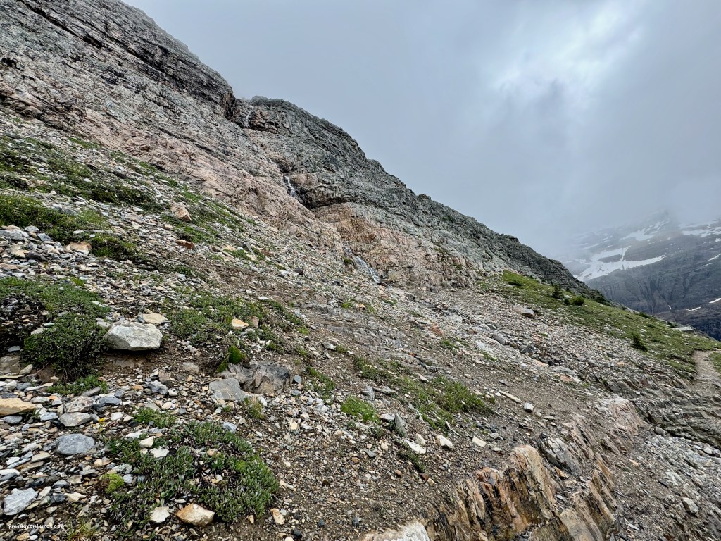
The weather forecast that was posted on the morning of August 7 made it seem like it would be a good day for me to hike the Alpine Circuit, as there was no rain in the forecast. The Alpine Circuit is not a traditional trail, but a set of four routes that traverse high above the Lake O’Hara basin on rough paths and exposed rocky ledges, with lots of steep ascents and descents – just the kind of stuff I love!
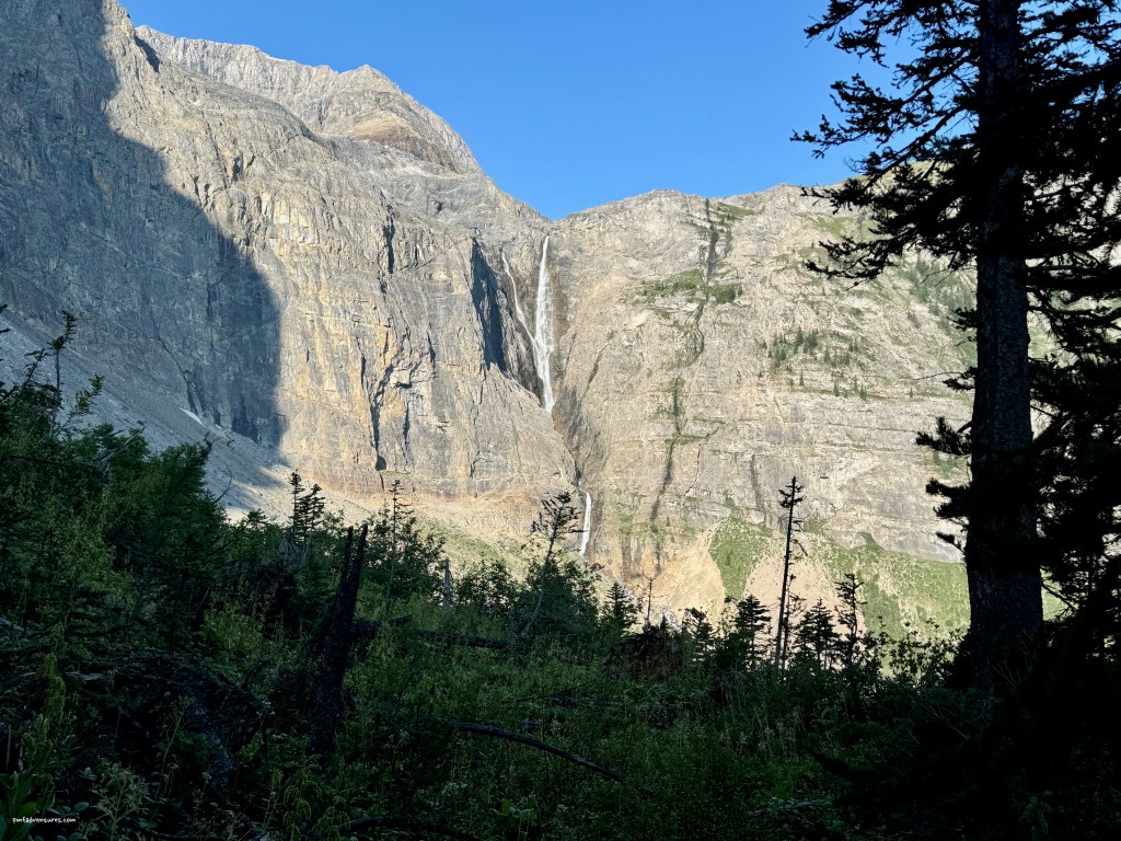
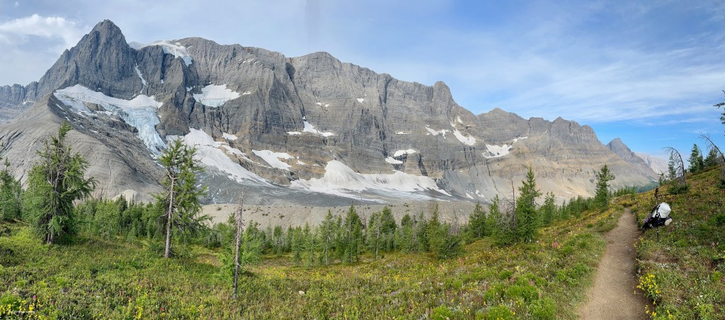
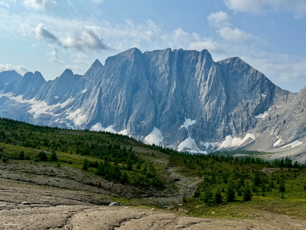
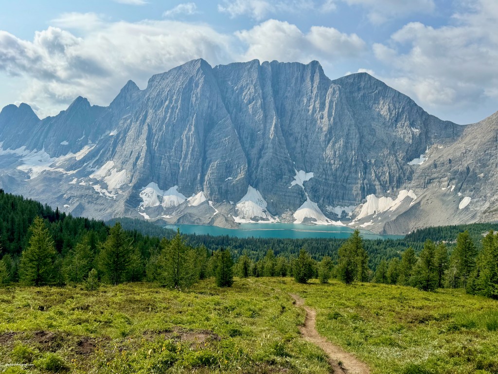
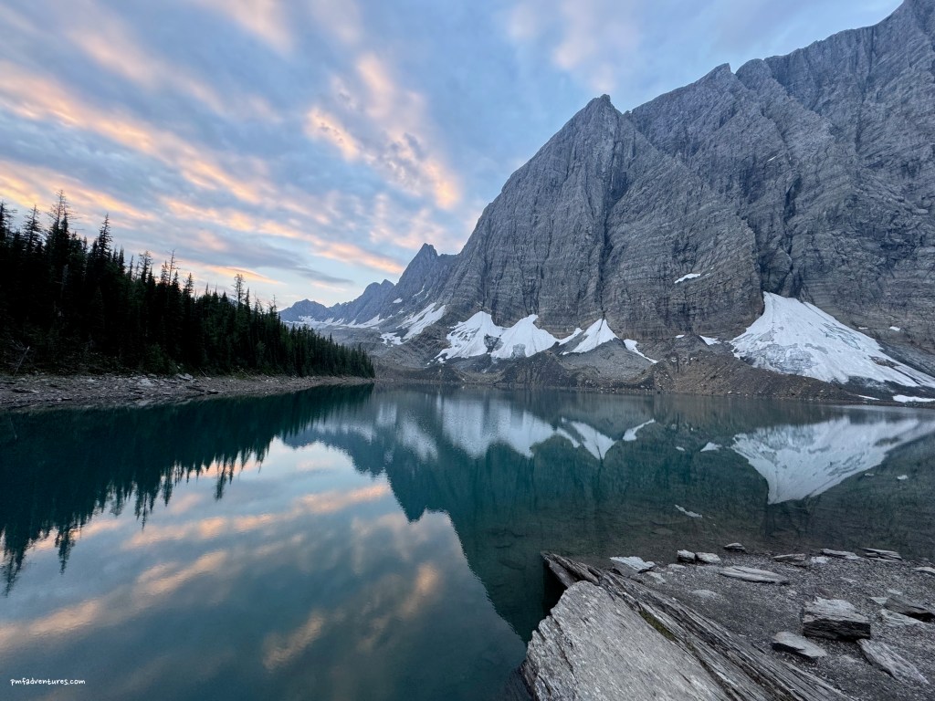
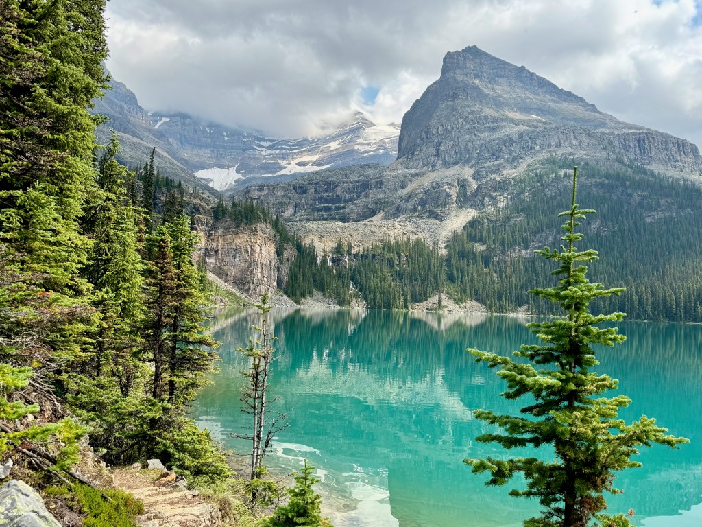
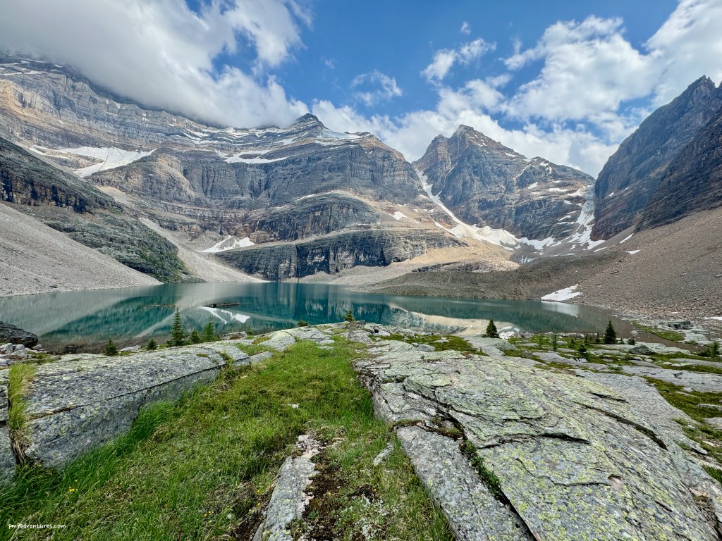
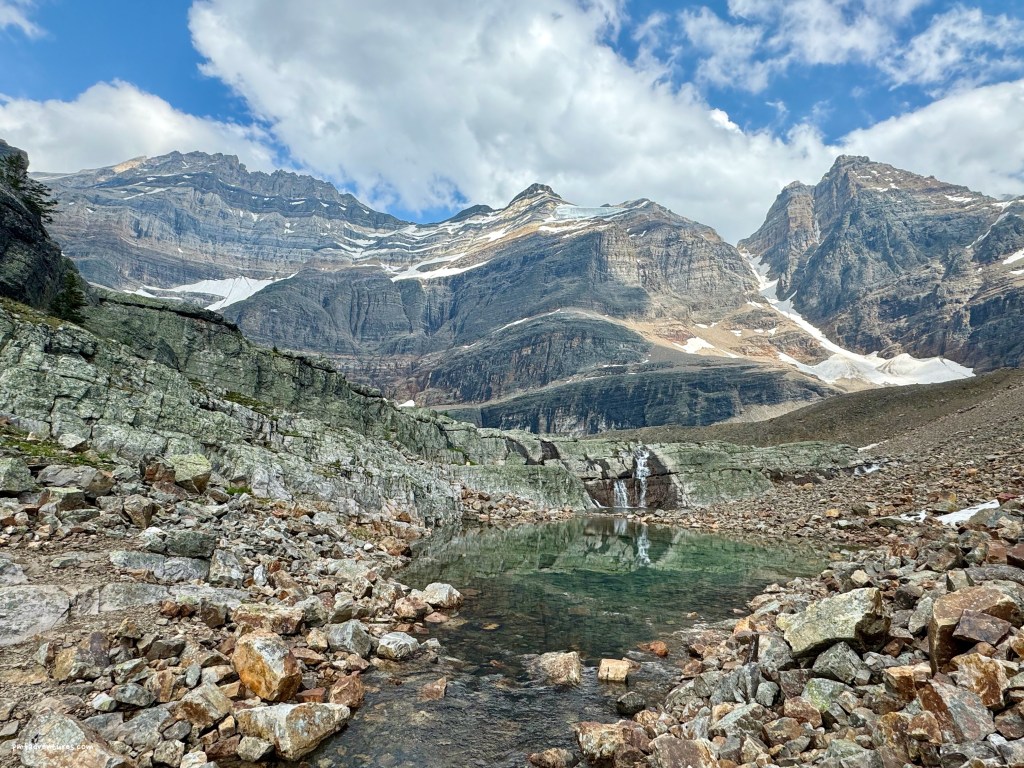
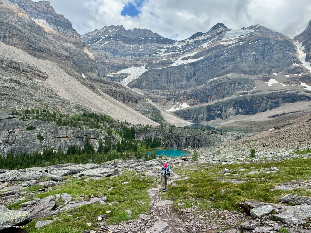
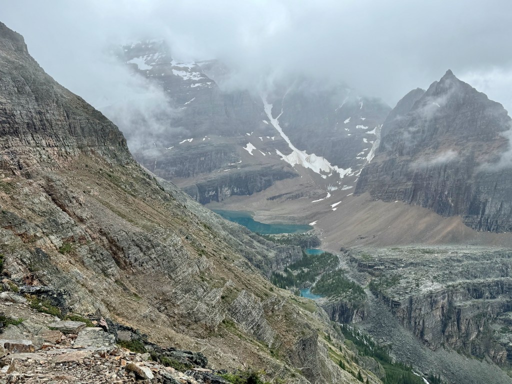
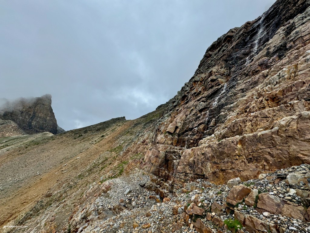
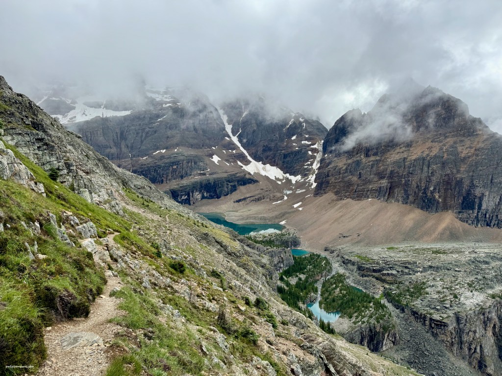
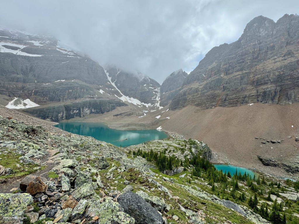
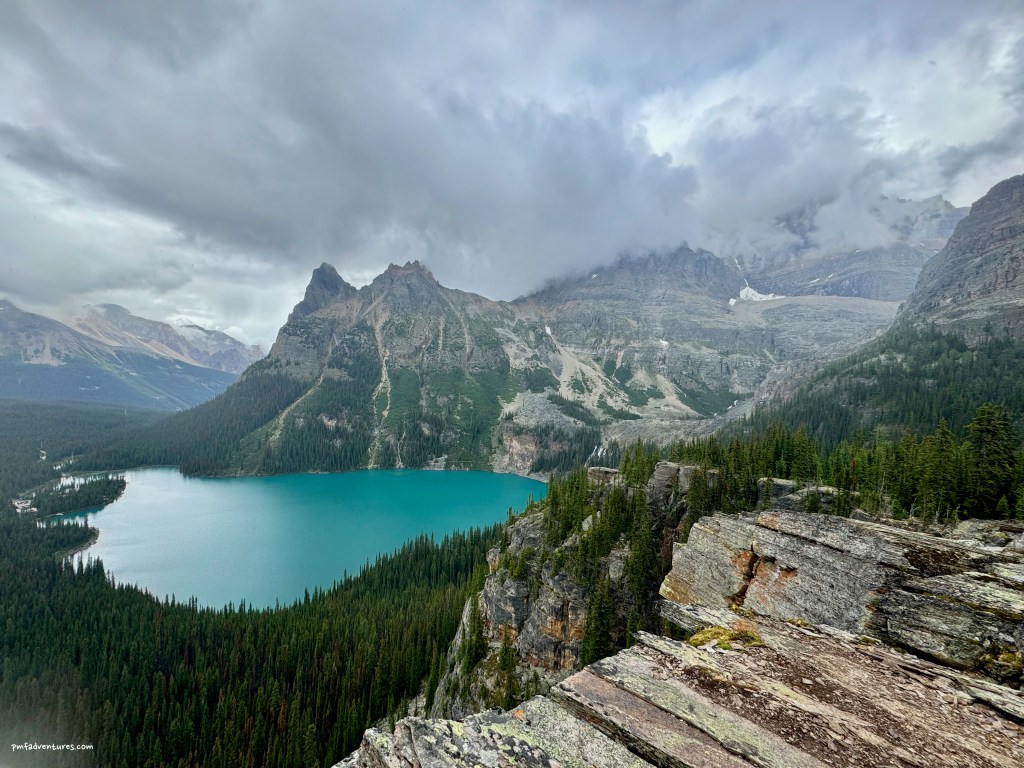
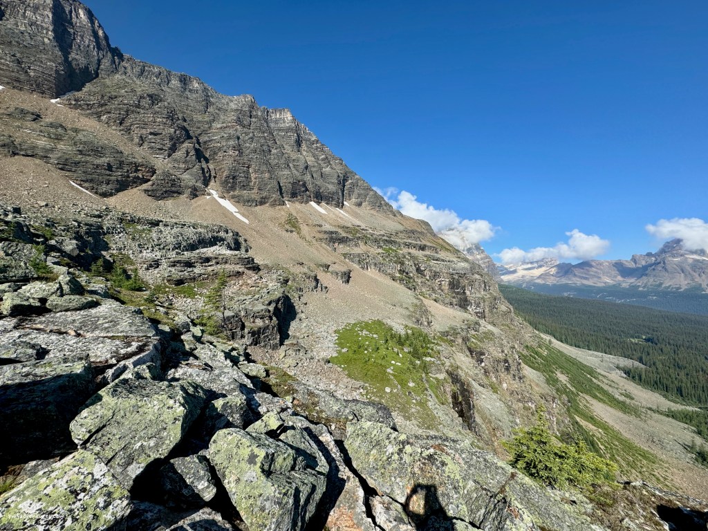
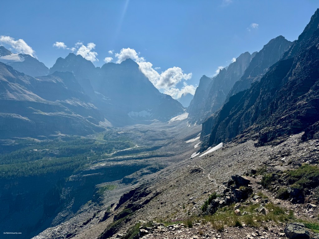
I started by ascending up to Wiwaxy Gap, a steep grind of about 1,700 feet in just under a mile. Although it wasn’t raining when I got to the gap, I could definitely feel mist coming out of the clouds. Then I traversed the Huber Ledges route down to Lake Oesa, passing several cool waterfalls coming off the cliffs along the way. By the time I got to Lake Oesa it was raining, so I donned my raingear and headed across the Yukness Ledges route that traverses Yukness Mountain. When I got to the Obapin Plateau, the rained had stopped and the weather seemed to be clearing, so I headed up to Opabin Lake and then came back to the Obapin Prospect to enjoy the view. At that point, it was clear that the weather was deteriorating, so I opted to head back to camp without finishing the final portion of the circuit. And I was glad I did, as it started pouring as I descended off the Obapin Plateau.
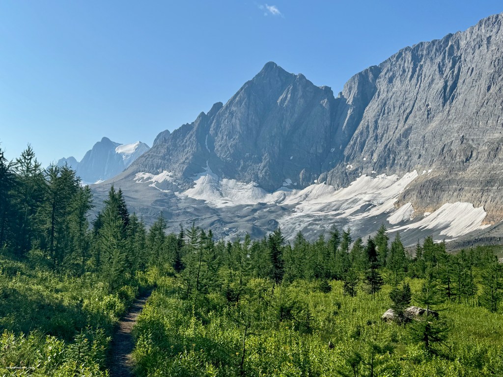
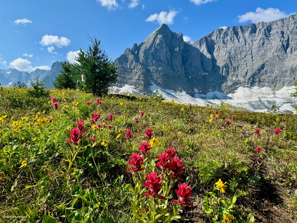
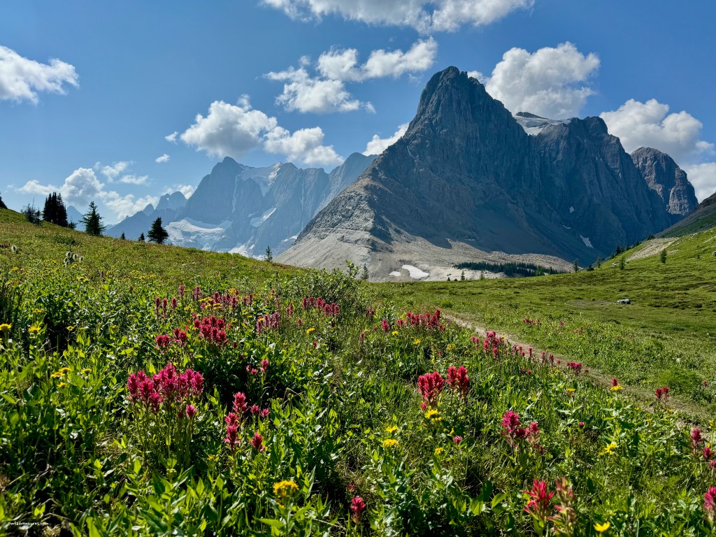
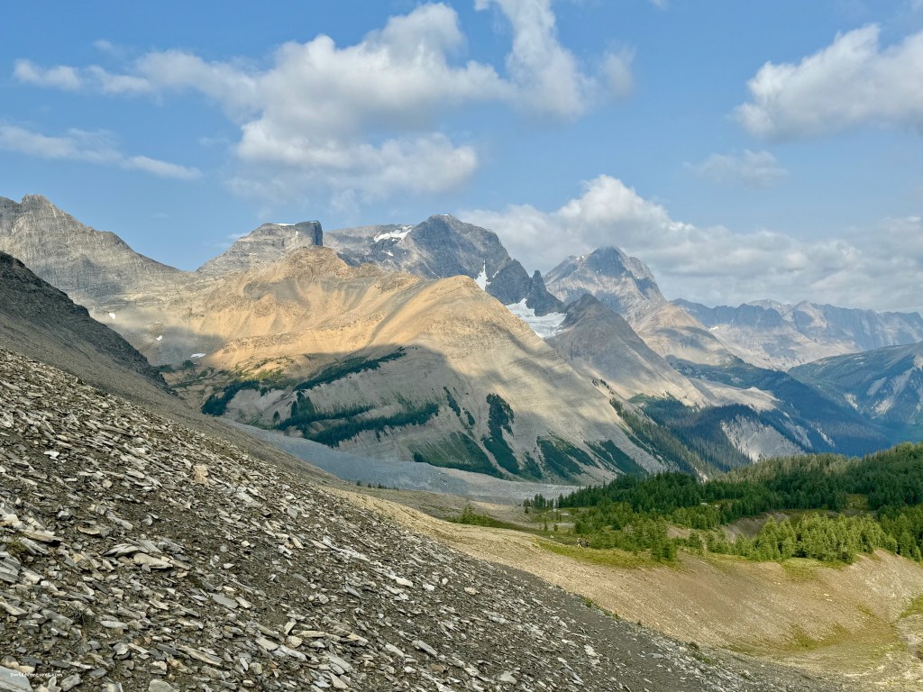
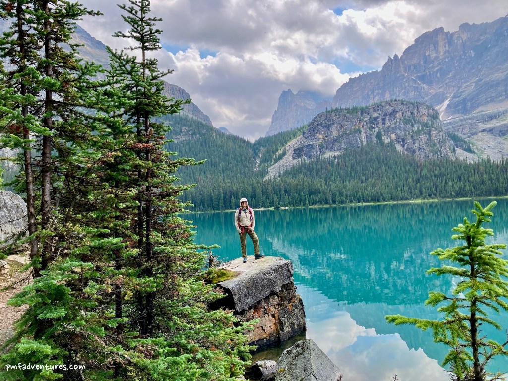
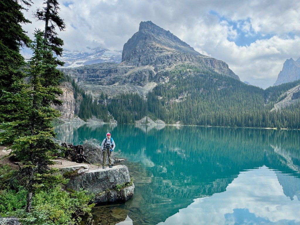
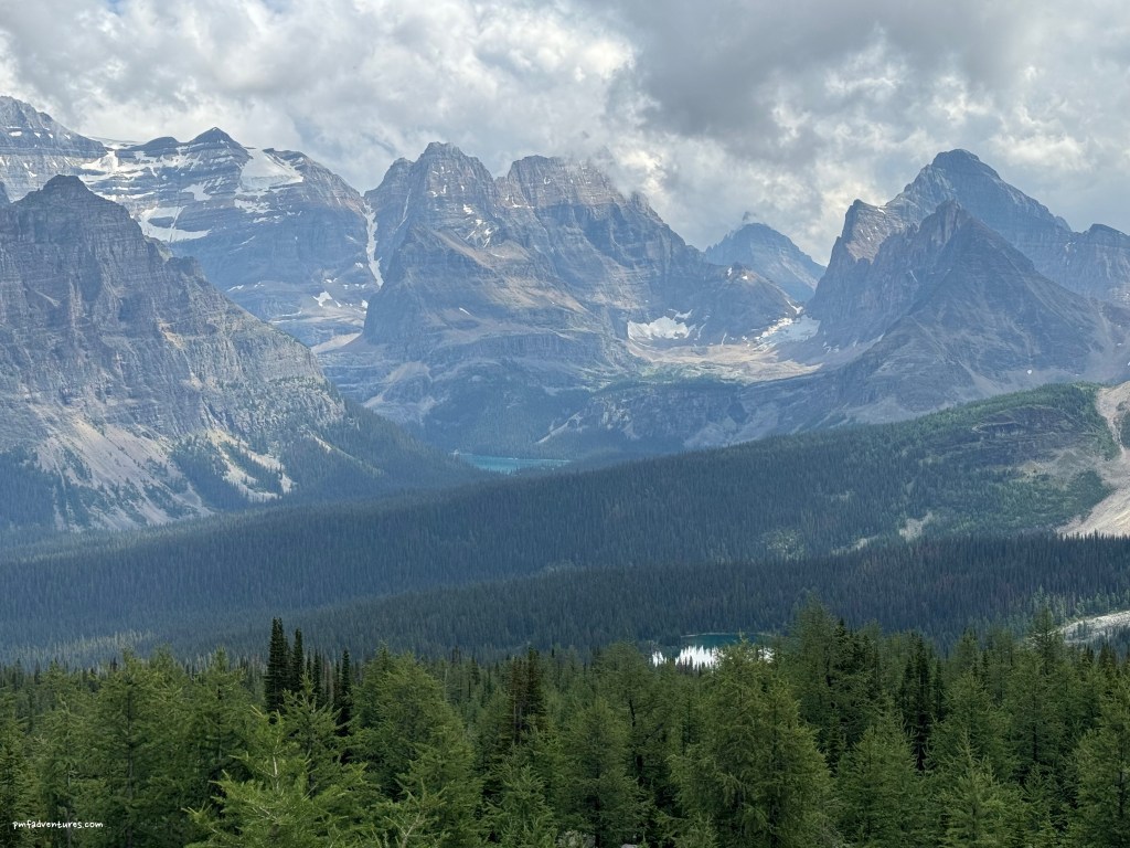
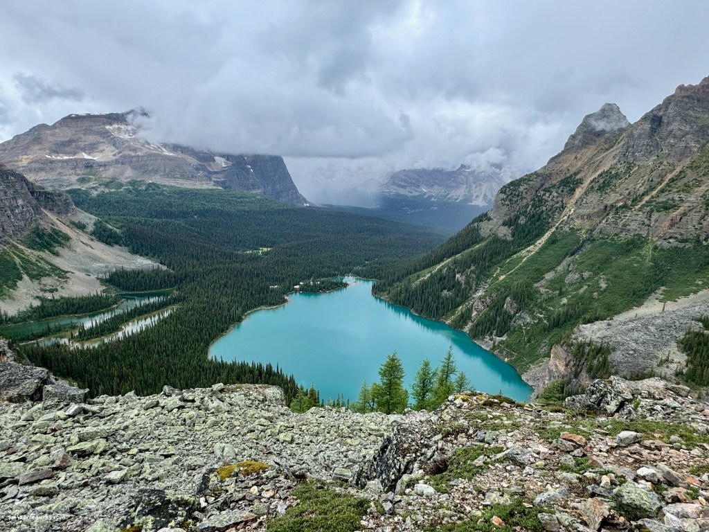
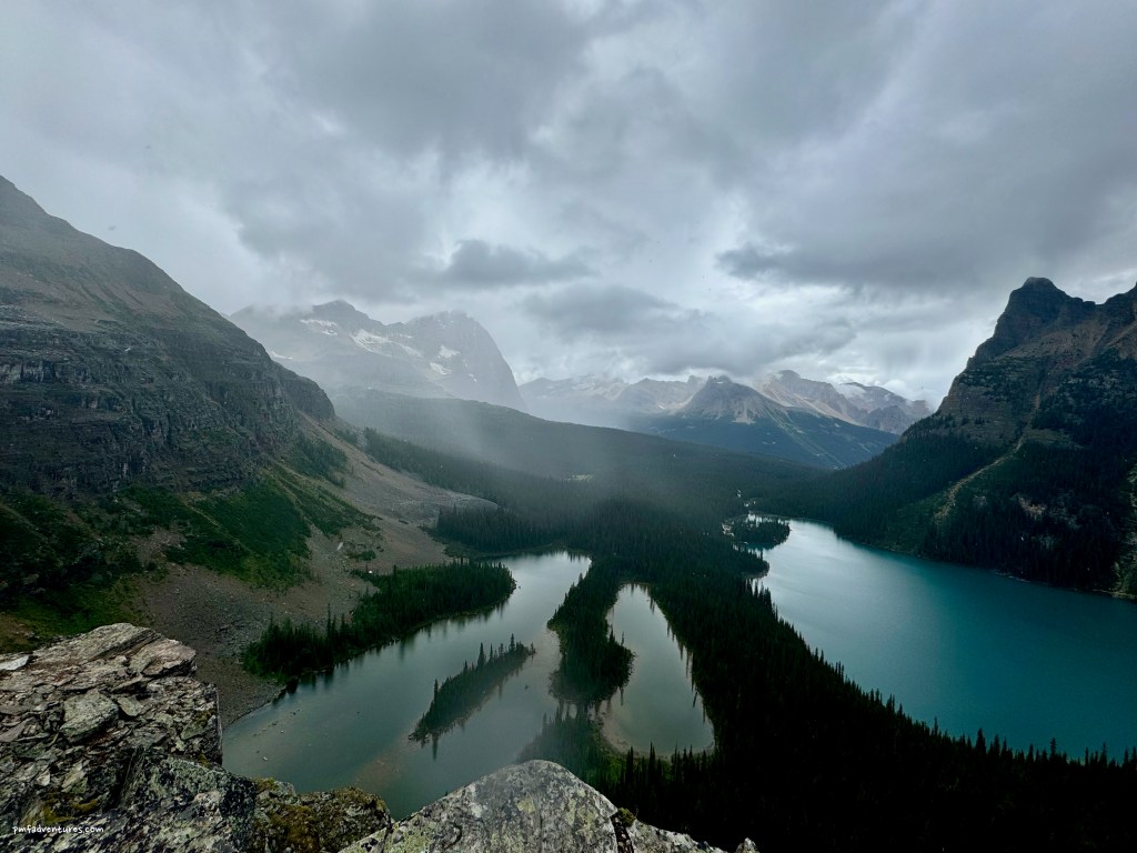
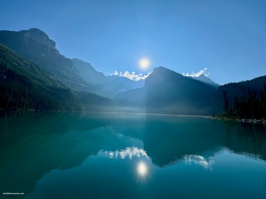
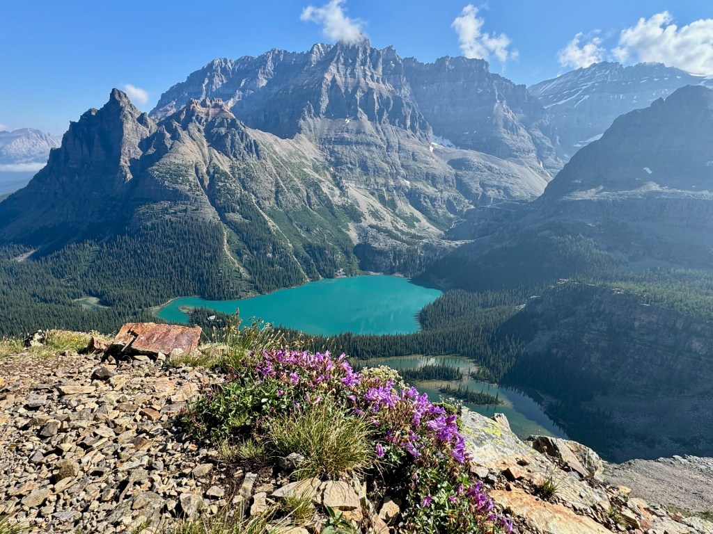
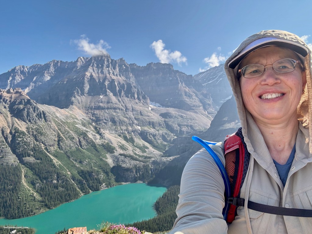
Our last morning was bright and sunny, but also quite chilly. We were planning to catch the 2:30 bus out, so we packed up camp quickly, as I wanted to take advantage of the great weather to do the final section of the Alpine Circuit. I hustled up the West Obapin Trail to get on the All Souls route, which climbs steeply across several rockslides before traversing beneath Mount Schaffer to All Souls’ Prospect. This is a wonderful viewpoint that looks across Lake O’Hara and allows you to see the entire route of the Alpine Circuit. After one last steep descent I had completed the circuit, which is hands down one of the best hikes I’ve ever done. And because I had done this last portion more quickly than expected, I had time for a side trip over to Lake McArthur before heading back to camp and catching the bus.


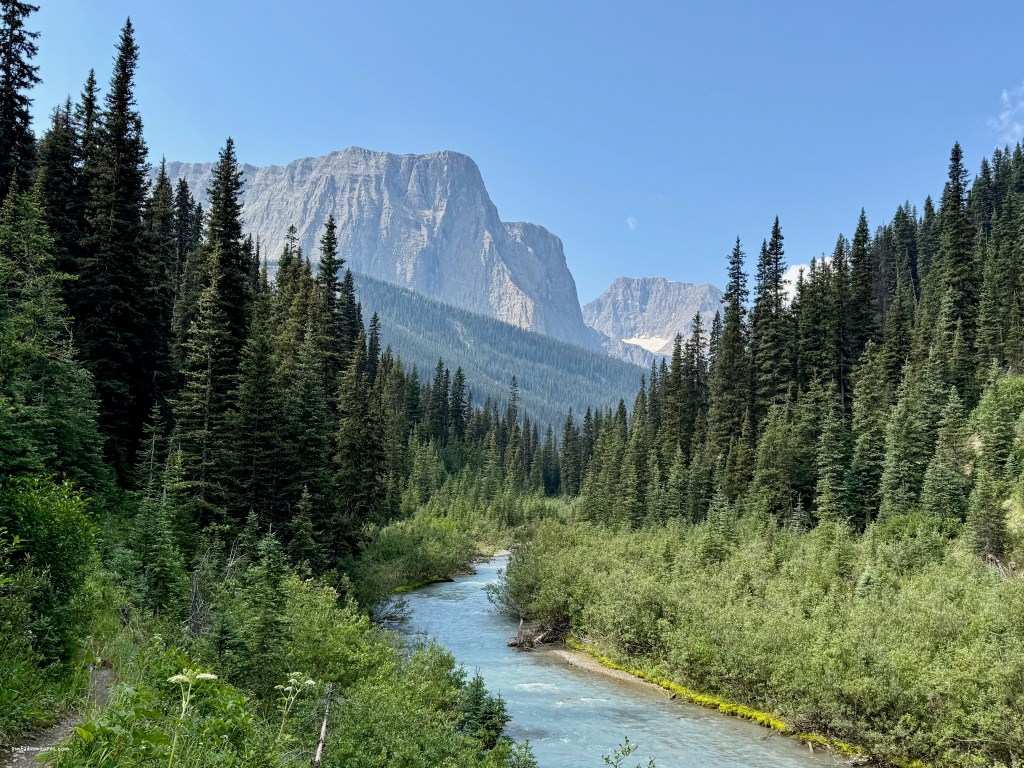
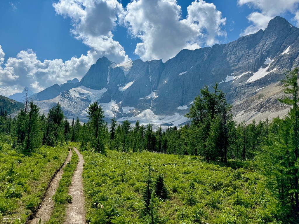
After we left Lake O’Hara, we headed to Kootenay National Park so that I could do a four-night backpack along the Rockwall, which is a sheer limestone wall that forms the eastern escarpment of the Vermillion Range. The Rockwall Trail is a classic 34-mile backpack that crosses three passes and travels for 18 miles beneath the Rockwall. I opted to do the trip from north to south, starting on the Helmet Creek trail and ending on the Floe Lake trail, with four nights in the backcountry. The weather forecast called for afternoon thunderstorms for my entire trip, so my plan was to start early each day and get to camp before the storms came in.
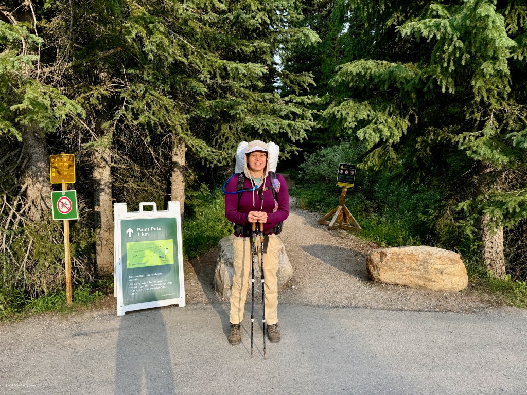
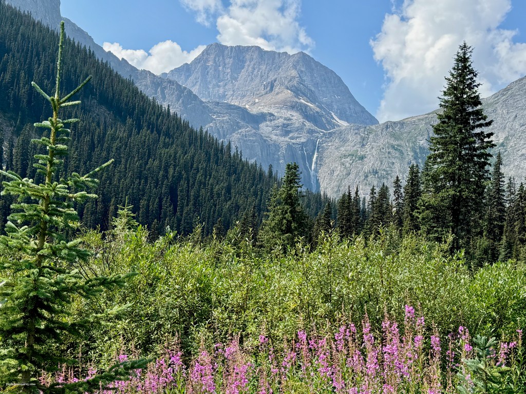
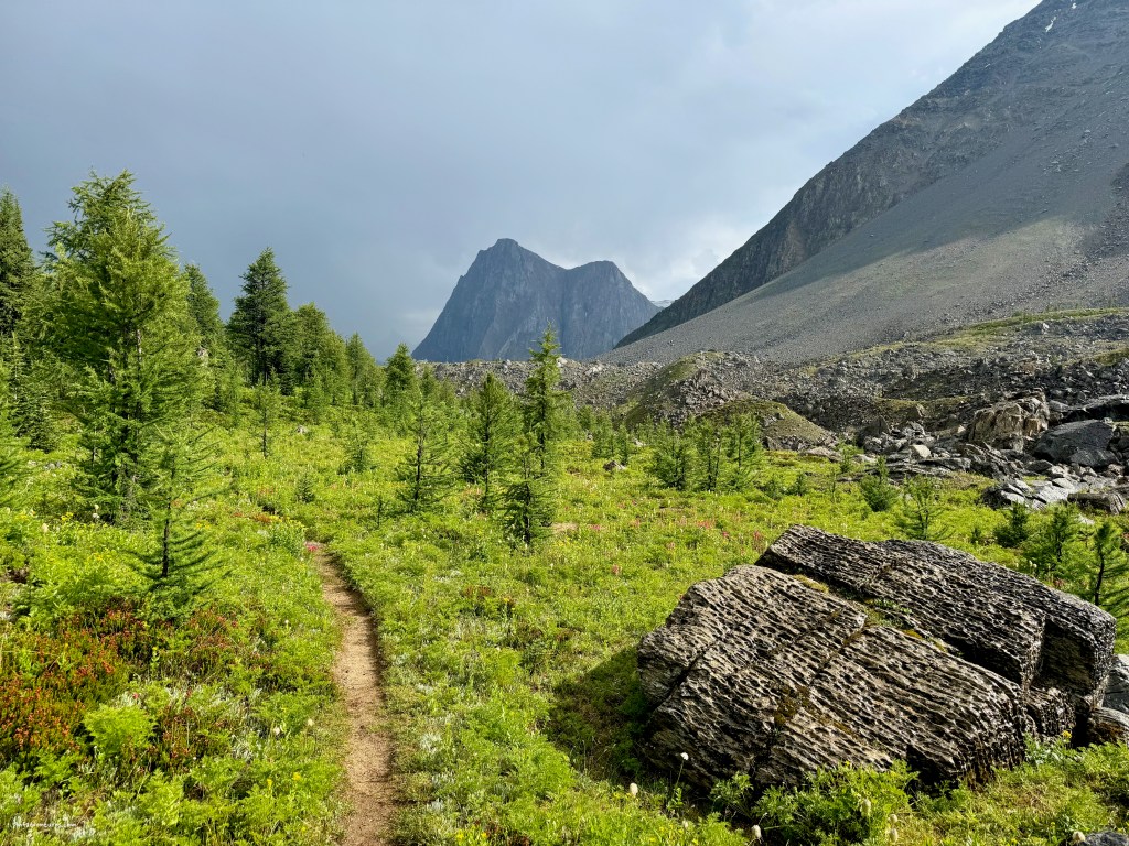
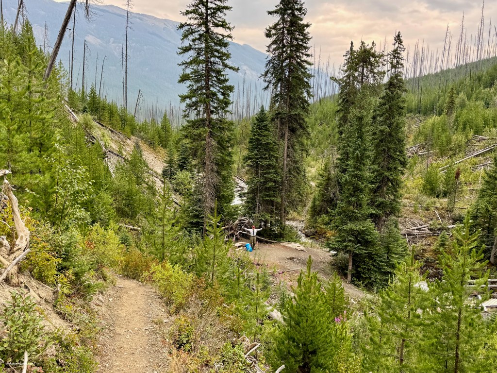
On the first day, I started at the Paint Pots trailhead and traveled 9 miles up the Helmet Creek trail to Helmet Falls campground. After setting up camp, I did a side hike up to Goodsir Pass and, as forecasted, it started raining about 3:30. But the rain stopped just after I got to the pass and I had a great view of the Goodsirs. The next day’s hike to Tumbling Creek campground covered 8 miles, with two strenuous ups and downs, first up to the Limestone Summit, then down to a hanging valley, then back up to Rockwall Pass before descending into the Tumbling Creek drainage. The flowers on Rockwall Pass were amazing and I also enjoyed a quick side trip over to Wolverine Pass before hustling down to camp. I had a chance to dry out all my gear and get camp set up before the afternoon storms arrived around 3.
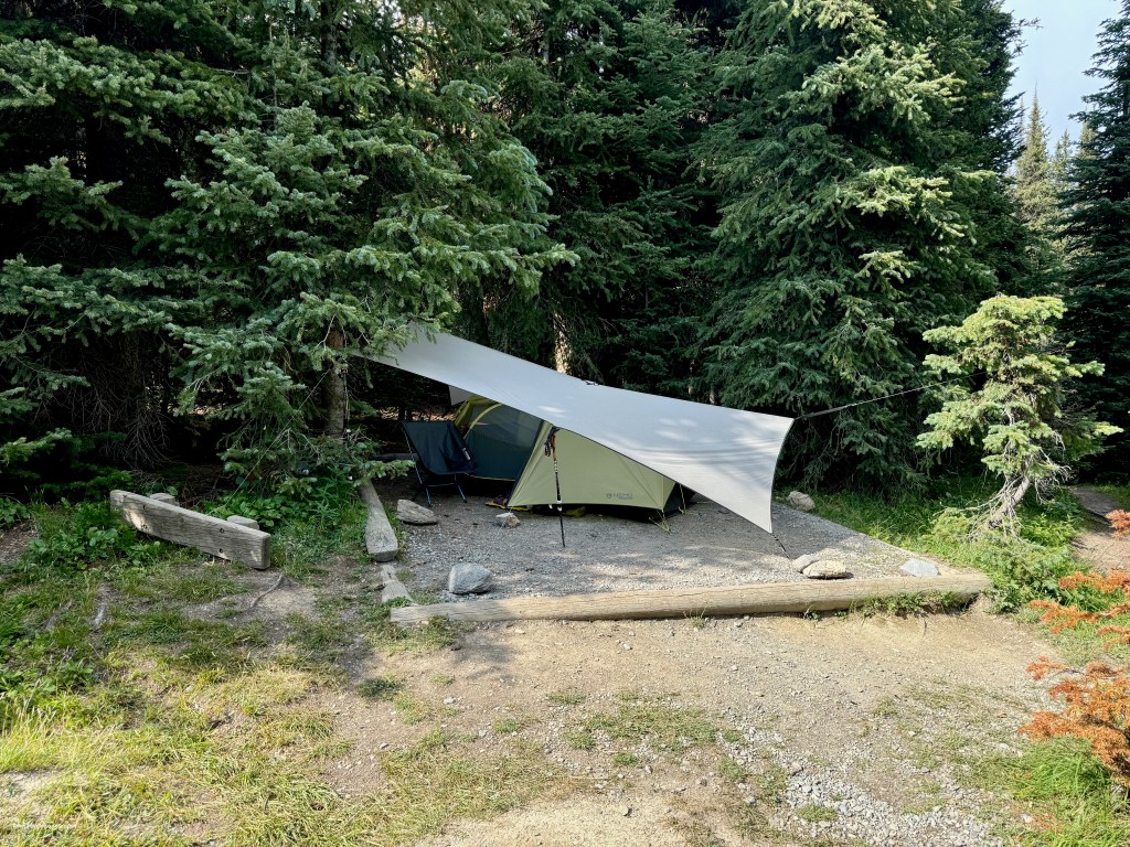
My third day was only 5 miles, but it included a gnarly climb up to Tumbling Pass before a long steep descent down avalanche chutes and a narrow overgrown trail into the Numa Creek drainage. I got a great campsite at Numa Creek campground that overlooked the creek and had good trees for setting up my tarp. The storms didn’t arrive until 5 that day, but when they did arrive it really poured, so I was happy to have a nice place to hang out. The next day’s hike was again pretty short, at just 6 miles, but it involved climbing up Numa Pass, the highest point of the trip at just over 7,700 feet, before dropping down to Floe Lake and its namesake campground. I got to camp before noon, hung a line to dry all my gear, and had camp set up before the storms came through right on cue at 3. On my last day, I got up early and enjoyed my morning coffee down by the lake, hoping to catch early morning light on the Rockwall, but got foiled by the clouds. So I packed up and headed down the last 6 miles on the Floe Lake trail to meet up with Sue, who had hiked a short ways up to meet me.